Greenland is an island with a distinctive shape, which virtually everyone in the world can recognise just by looking at the outline of the country. When describing the geology of country, it is important to distinguish between when it is about landscapes, when it is about what materials the rocks, the mountains are made of, and when it is about where the material the rocks are made of came from. All this is also related to when and how Greenland became an island.
The deep structures
BO ELBERLING, 2021
Roughly speaking, the country looks like a giant ice cream cone with the tip facing south. The east and west coasts form the cone’s acute angle, while the north coast forms an obtuse angle with the tip facing the Arctic Ocean.

BO ELBERLING, 2021
If you let your eye run up along the two ‘cone coasts’ to the east and west, you quickly notice that the vast majority of fjords, valleys and glaciers along the west coast are oriented NE-SW, roughly parallel to the country’s northwest coast and Nares Strait towards Canada. Similarly, the fjords are oriented NW-SE along the east coast, roughly parallel to the eastern north coast.
The reason is the continental plate collisions that happened between 1,900 and 1,700 million years ago: An ocean plate from the south thrust under what was to become Greenland, and old existing continental parts merged into one whole. The part of the country situated south of Arsuk was created of new magma formed by the melting of the Earth’s mantle and sediments and ocean floor which was pulled with the ocean plate down into the depths. The rest of the country is dominated by recycling of older continental fragments.
It could be seen as a geological collision. A number of smaller continental blocks were hit from the south and the collisions propagated through the system as if a large truck had hit a queue of smaller cars. Some were simply badly deformed and others were stacked on top of each other. In the geological version, smaller sea basins – the roadway between the cars – were folded into the continents as they collided. The stacked ‘cars’, the continental plates, rose like mountain ranges of a scale like the Himalayas today. With this, the deep bedrock under Greenland was welded together, and the country has never divided since.
Experiments have shown that if you squeeze a rock block from the south and north, it will start to crack in two orientations, NE-SW and NW-SE. The fine details in the coastline, the fjords, are a result of the fact that the ice has had an easier time eroding the land along the cracks that propagated through the country when the continental collision took place some 1,800 million years ago.
The country finds its form
Greenland has a very long formation history, which includes virtually all types of geological processes throughout the Earth’s geological history. The land we call Greenland was not formed as an island; it is a fragment of a continent that was broken up into smaller pieces by the continental drift across the face of the Earth. The geology of Greenland must therefore be understood in the context of its surrounding areas; the country is a piece of a puzzle which includes Scandinavia, parts of Russia, Canada, the Faroe Islands and the British Isles.
The supercontinent is broken up
175 million years ago, all the continents of the Earth were joined in one so-called supercontinent, stretching like a belt from the North Pole to the South Pole. The idea that all the Earth’s continents were once joined together in one continent, was fostered by Alfred Wegener during the Denmark Expedition to Northeast Greenland in 1906‑1908. He called this whole primeval continent Pangea. Wegener suggested that the land masses are in constant motion, drifting around the Earth’s surface. 330 million years ago, all continents had collided with each other and had begun to move as a total mass, Pangea.
175 million years ago, the supercontinent began to crack and different parts drifted in different directions. Africa started to drift away from South America 150 million years ago. The cracks between the two parts were filled with basaltic magma which rose from the hot interior of the Earth. The cracks propagated northward, like a zipper that quietly opened from south to north. As the basalt-filled crack landscape evolved, it was flooded by the sea, forming what we know today as the Atlantic Ocean.
90 million years ago, the crack system had reached the level of South Greenland. Greenland, along with Europe, was drawn east, while Canada and the United States drifted west, and the Labrador Sea opened up between West Greenland and Labrador.
Sea basins are formed
When a continent breaks up, it happens due to forces pulling in different directions. First, the land yields as much as it can, by the crust being pulled thinner until cracks appear and finally a final fracture. This development is important for the geology along the coast of West Greenland, where the deformed crust sank in some places and was flooded by the sea. This led to the formation of a number of basins in the seabed off Greenland, including in Qeqertarsuup Tunua (Disko Bay) and around Nuussuaq Peninsula.
The basins were gradually filled with sediments and dead plants, animals and planktonic organisms which over time were transformed into coal, oil and gas. It is that part of the creation history which forms the basis for the hopes for oil and gas deposits off Greenland, and which created the coal layers that were mined during the last century’s mining in Qullissat.
Lava builds up basalt layers
Greenland could very well have been part of Europe today had Iceland not entered history. Before Greenland and Canada were completely separated, the continent passed over a stream of hot material that rose from several hundred kilometres depth in the Earth’s mantle – known as a ‘hotspot’. The hot material began to melt, and large amounts of magma rose upwards towards the surface. It flowed out through the many cracks and zones of weakness that had emerged during the progressive split between Greenland and Canada and through zones of weakness along what is now the east coast of Greenland.
The coincidence between the fracture and the hotspot created the giant layers of lava that cover Qeqertarsuaq (Disko), Nuussuaq and Svartenhuk in West Greenland, Baffin Island in Canada and the Blosseville Coast in East Greenland.
Over the course of 10 million years, millions of cubic kilometres of lava built up to 7 km thick basalt layers which today dominate the landscape in the western part of Qeqertarsuup Tunua (Disko Bay) and north to Upernavik, and the Blosseville Coast in East Greenland.
The continent cracks
The continental plate continued its drift across the warm current, while volcanism continued. The constant flow of hot material from the Earth’s deep mantle created a huge bulge under the country. This led to land uplift and to the crust being stretched. What is now Greenland’s east coast had formed the coast of a now vanished sea, the Iapetus Ocean, 600 million years ago. This ancient fracture zone proved to be a zone of weakness in the entire Europe-Greenland region of Pangea. The continent cracked and the opening of the Atlantic Ocean, which had otherwise tried to wedge itself between Greenland and Canada, jumped to between Greenland and Europe. Northeast Greenland and Norway became geological mirror images of each other, and many features of South Greenland’s geology can be followed through Scotland, northern Scandinavia and into the Kola region of Russia.
Pieces of the thick layers of basalt from the east coast of Greenland followed Europe to the east, where they now form the Faroe Islands, the Hebrides and parts of Ireland. We can still see that the Faroe Islands were connected to the Blosseville Coast, because layers of lava from a few specific volcanic eruptions 55 million years ago have one half in East Greenland and the other in the Faroese mountains. The hot stream from the mantle still produces large amounts of lava and is called the Iceland Hotspot because the volcanic island of Iceland is where the volcanism can be seen on the surface.

BO ELBERLING, 2016
The continent’s old coast – North and Northeast Greenland
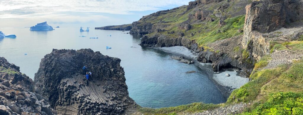
North Greenland and Northeast Greenland are geologically very fascinating areas where it is still possible to see the coastline of the continent, which was created by the tectonic plate collision 1,800 million years ago. It is possible to stand on the interface where sediments have settled on top of the gneiss from the old bedrock. It is reminiscent of the sabkha environments found in Arabia today. A marsh-like coast with dunes and lakes, which have occasionally dried out, leaving drought cracks and salt crystals, which can still be seen as imprints in the sandstone today, almost two billion years later.
If you walk across the huge sediment platform from the edge of the ice sheet towards the coast, you encounter younger and younger deposits. You can stroll through a billion years of geological history, and see the results of dramatic upheavals in the Earth’s climate that have changed the conditions of life on Earth. After the deposition of the sandstone layers, thick layers of basalt are found, formed by a new fracture 1,250 million years ago. This is followed by 400 million years with no preserved deposits, most likely because they have eroded away.
Supercontinent Rodinia
Greenland enters history again about 850 million years ago. The entire North American-Greenland continent, Laurentia, was now part of a coherent supercontinent, Rodinia, which in many ways corresponded to the later Pangea. North Greenland was still on the edge of the continent, with the coast at the current ice edge line. From here, a shallow shelf stretched about 100 km north, and was replaced by a deeper ocean basin towards what is now the Arctic Ocean.
At the bottom of the deposits, and thus first, coarse sand is deposited, close to the shore. Higher up in the deposits, and thus later in time, finer sand and mud are deposited, which typically represent deeper and calmer water, and then limestone and then sandstone again. Together, the deposits are about 1,000 m thick, and they are all deposited at a depth of a few metres in the sea.
But how does that add up? A sea basin that can hold 1,000 m thick layers of sediment must be at least 1,000 m deep? This actually illustrates the dynamics involved in the movements of the continental plates and the opening and closing of oceans. The thing is that stretching the continental crust has led to the sinking of a basin on the shelf. As the basin has sunk, it has become filled with sediment. The sediment has weighed the crust and pressed it down, and the stretch has created space for the basin to sink at a rate making it shallow throughout the period, or at times dry.
From microbes to the earliest fauna
Many of the limestones in North and Northeast Greenland are made up of millimetre-thin layers, which form irregular undulating layers and cauliflower-like structures. It shows that part of the limestone is formed by microorganisms, which have accumulated in layers on the seabed, and protected themselves from the external environment with layers of mucus. Small limescale particles have been continuously trapped in the mucus layer, and have blocked the sunlight. The microorganisms have therefore grown up through the lime layer, and have formed a new mucus layer. The process has been repeated over and over again and has created the thick flaky deposits – stromatolites. They represent the more than three billion years of Earth’s history, in which animals and plants had not yet come into being, and all life consisted of microbes.
In the sandy layers on top of the stromatolites in North and Northeast Greenland, however, some small tubular structures begin to appear in the sandstone. These are burrows, made by some kind of early animal, which is probably reminiscent of sandworms. With this, we enter a whole new era of Earth’s history. A world of animals and plants – perhaps not a modern world, but something that is beginning to resemble it.
The total glaciation
WALTER MYERS/SCIENCE PHOTO LIBRARY/RITZAU SCANPIX, 2010
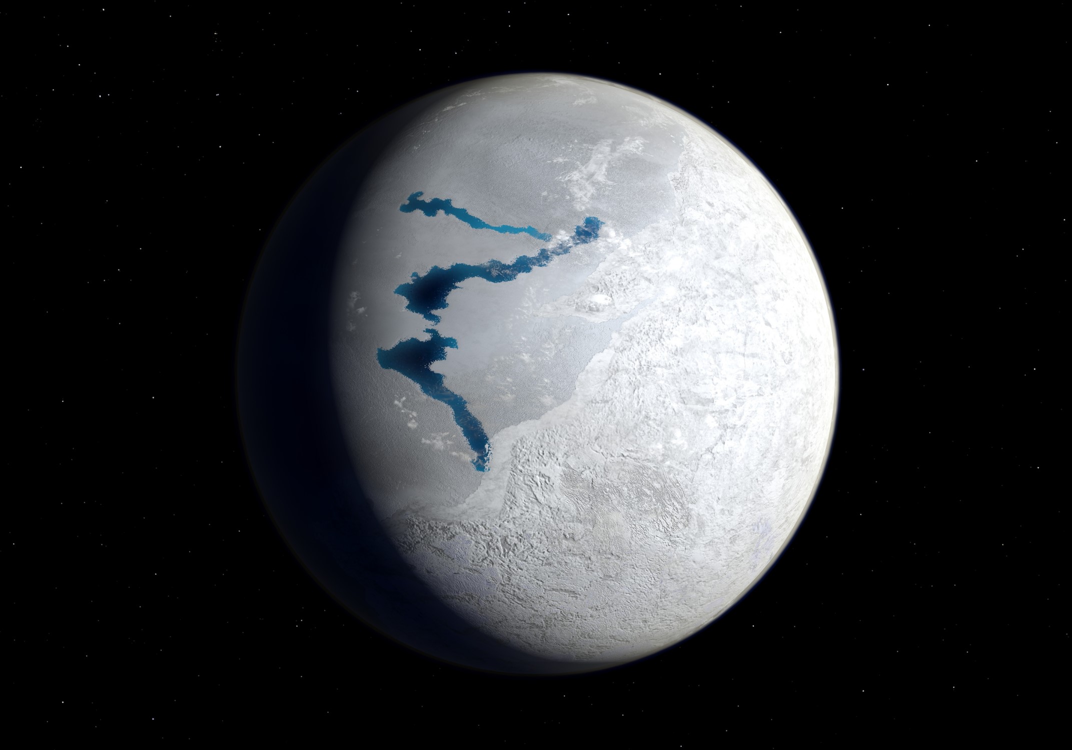
The theory called Snowball Earth puts forward the thesis that, for yet unknown reasons, the Earth’s climate became significantly colder about 700 million years ago – a theory that builds on findings of moraines from an early glacial period.
From the plate tectonic evolution of the Rodinia continent, a prior tropical environment, represented by sabkha deposits and limestone, can be detected. At the time when they were deposited, Greenland was right on the equator, the hottest zone on Earth, and the country was still on the equator when the moraine layers were formed. This shows that the climate at the equator 717 million years ago was like at the South Pole today.
Ella Island, or Ella Ø, in King Oscar Fjord in Northeast Greenland is one of the finest examples of the transition between tropical and glacial climate, but there are similar deposits from this period on all continents. Earth had probably been glaciated twice or more over a period of 90 million years, and the climate crisis was apparently a unique event in Earth’s long history. If so, life somehow – open cracks in the global ice cover, a floating ocean beneath the ice – managed to get through the unimaginably long winter, and traces of the earliest animals on Earth occur shortly after the end of the global glacial period.
Evolution picks up speed – Animals emerge
Just north of J.P. Koch Fjord in Peary Land is the Sirius Pass. It intersects limestone and black shales from the earliest part of the Cambrian, which marks the transition to the Phanerozoic, the geological Aeon, where animals and plants occupy the Earth. In 1984, in the black shale at the mountain of Buen, an expedition from the Greenland Geological Survey, now part of GEUS, found some fossils that did not look like anything ever seen before. However, they did resemble some fossils found in the Burgess Shale in Canada. Fossils are mostly made up of skeletons, but these were preserved traces of animals without skeletons or with preserved soft parts that had never been studied before.
The Sirius Pass suddenly provided insight into some of the first animals that emerged in the ocean and follow how today’s animal groups evolved in an astonishingly short time. When a shale block from the Buen Formation is split, it shows a picture of the Cambrian explosion frozen in time. It gives a snapshot of a brief hectic evolutionary event in which all the genera of animals that populate the Earth today emerged. As far as is known, the age of the layers of Sirius Pas can be determined at around 513 million years.
A supercontinent is breaking up
By this time, the Rodinia supercontinent was breaking up, and a sea, the Iapetus Ocean, had started to wedge itself down between Greenland and Norway. The Baltic continent was separated from Laurentia and along the coasts of the two new continents, kilometres of sediment layers were deposited until the ocean closed again and Baltica and Laurentia collided again 425 million years ago, as part of the construction of the Pangea supercontinent.
Formation of sedimentary basins
However, this did not mean that this was a period of geological calm in the region. The formation of the Caledonian mountain range was, like most mountain ranges, followed by long-term adjustments of the continental crust. The joint where the continents were ‘glued’ together, and where the Iapetus Ocean had been, continued to form a zone of weakness in the crust. Over the following many millions of years, a number of basins emerged along what are now the coasts of Greenland and Norway. Some were connected to the sea and were filled with limestone, shale, and other marine sediments. Others were continental basins filled with red desert sand, and others still represent shallow coastal swamps. These basins can now be found consecutively through the mountain landscapes from Kangertittivaq (Scoresby Sound) and up through Crown Prince Christian Land which forms the northeast corner of Greenland.
These sedimentary basins are, individually, small geological treasure chests, illustrating different parts of the Earth’s recent geological history. During the Danish East Greenland Expedition in 1931, remains of Ichthyostega, the ‘four-legged fish’, were found at Celsius Bjerg in the fjord complex north of Mestersvig. Here, we find deposits formed in a shallow swamp area during the Devonian period about 370 million years ago. Ichthyostega had features reminiscent of fish, but also limbs like the Tetrapods – the four-legged vertebrates on land, and they were able to both walk and swim through the swamps. They are considered the earliest form of land animal.
Climate catastrophe and mass extinction
ELISE BIERSMA, 2021
Further south, on the Jameson Land peninsula, just north of Kangertittivaq, there are thick deposits from the geological time periods Triassic, Jurassic and Cretaceous and, where the peninsula is connected to the mainland, also layers from the older time periods Carboniferous and Permian. Again, a climatic drama can be followed through the geological layers.
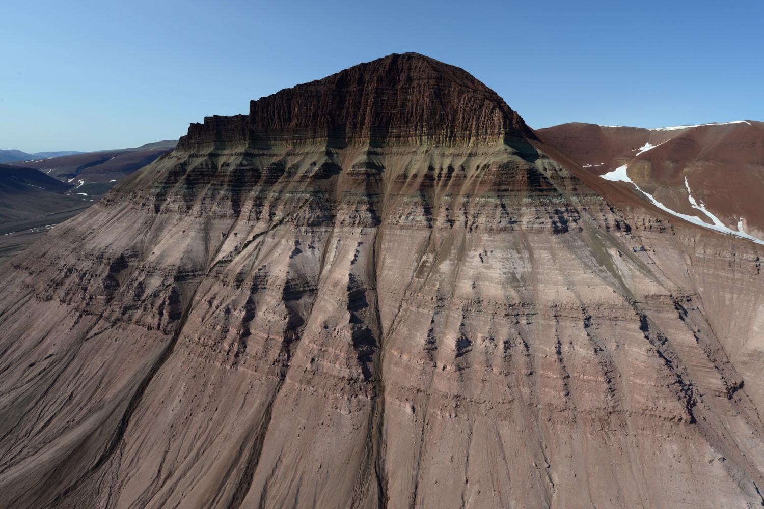
The Permian period ended rather abruptly 252 million years ago, with the most violent mass extinction the Earth has ever experienced. More than 90 % of all animal species living in the sea and 70 % of the many species of vertebrates that populated the terrestrial soil died within a very short period of time due to a severe climate crisis. It seems that the Earth’s average temperature rose around 10°C, due to a sharp increase in the CO2 content of the atmosphere. There are indications that a combination of volcanism and fires in the thick deposits of coal that had formed in the preceding Carboniferous triggered the climate catastrophe.
Recent times – Mesozoic
The catastrophe has left its mark on the northern and eastern Jameson Land. Here you will find the most incredible red mountain landscapes made of desert sand from the scorched earth.
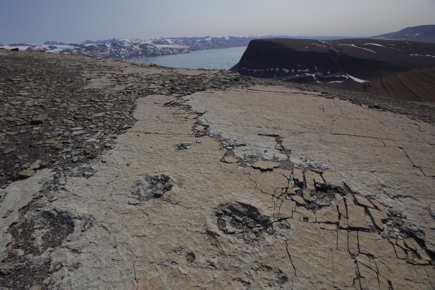
The violent wave of extinction of animal species, as always, led to a huge leap in animal evolution. New species of animals and plants emerged. One of the groups of animals that rose from the ashes after the Devonian extinction were the dinosaurs. In the mountains around Carlsberg Fjord, you will find dinosaur skeletons, and the traces of dinosaurs that walked around more than 200 million years ago are still clearly visible in the layers that formed the Earth’s surface at that time.
In central Jameson Land, there are also thick deposits from the Jurassic and Cretaceous, where the sedimentary basins again sank and were flooded by the sea, as a result of Pangea’s incipient fragmentation. Greenland was still connected with Norway, the Faroe Islands and Scotland, and Iceland did not exist yet. During that period, a number of sedimentary basins were formed in the zone between Greenland, the British Isles and Scandinavia, just as similar basins arose along the west coast of Greenland. These basins are the source of the Norwegian oil wealth and the source of the Danish and British oil fields in the North Sea. This also makes them the source of Greenland’s hope to find oil within its own territory.
Greenland chooses side
At the end of the Cretaceous, the Labrador Sea first opened between Greenland and Canada. Since then, the old quarry from the Iapetus Ocean sprang up again and Europe began drifting eastward, while Greenland continued along with North America to the west. The thick layers of basalt, from the lava that flowed out through the cracks, are now seen in the steep carbon black rock walls along the Blosseville Coast, Svartenhuk, Qeqertarsuaq (Disko) and Nuussuaq, and the highest mountain in the Arctic, Gunnbjørn Fjeld, consists of lava that flowed out back when the North Atlantic was born.
When life started to take shape

MINIK ROSING, 2010
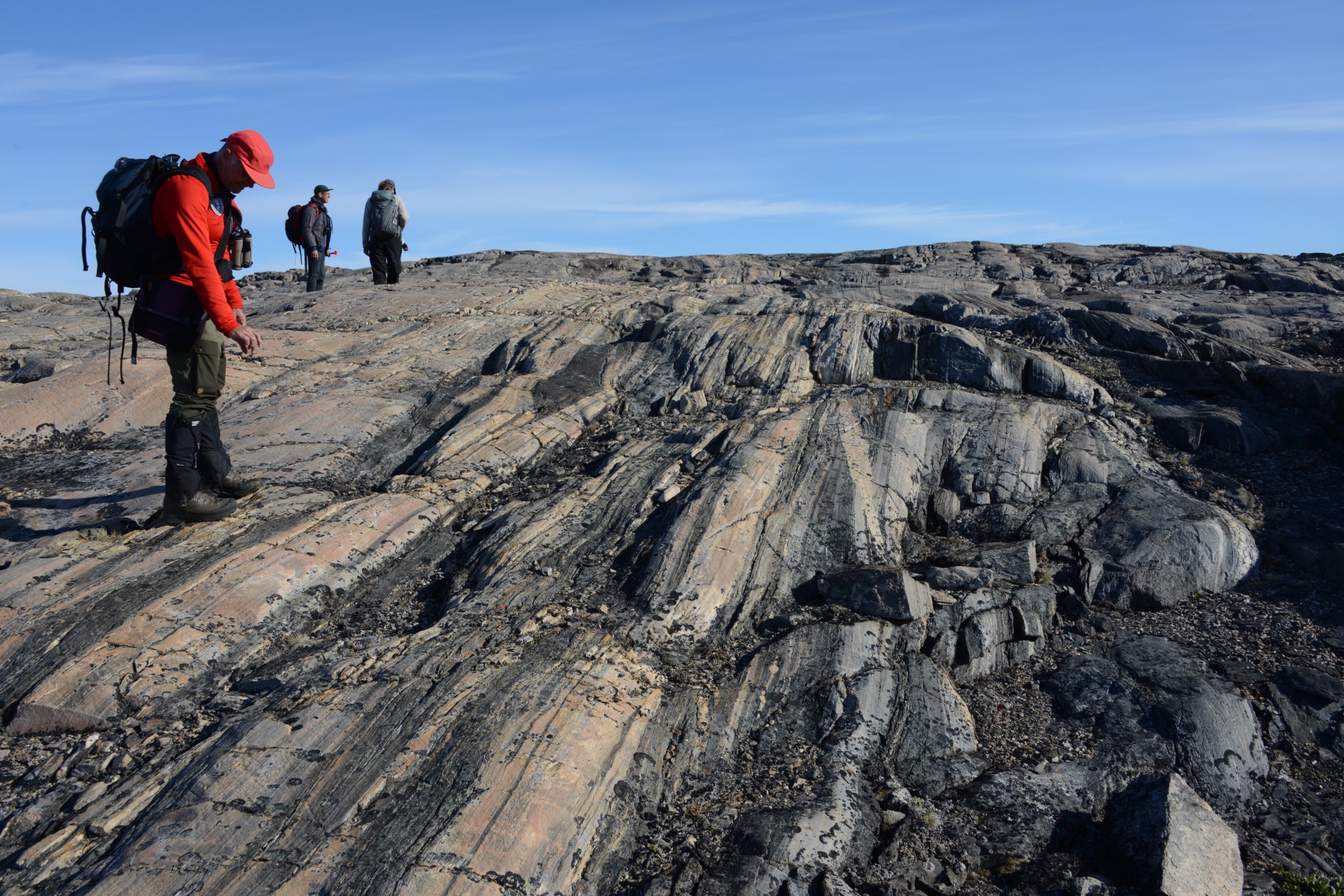
Like everywhere else, the bedrock in Greenland is rather uneventful, some would say boring. However, a tiny piece of bedrock from Isua 150 km north-east of Nuuk calls for special attention. In the late 1960s, it was discovered that the grey gneiss in Nuup Kangerlua (Godthåb Fjord) was more than 3,600 million years old, and thus significantly older than anyone had imagined that rocks could be.
At the same time, the Danish cryolite company Kryolitselskabet Øresund discovered an occurrence of iron ore of a special striped or banded type, which was deposited as a sediment in the sea in the Earth’s early childhood. It turned out that there are very small pockets of wellpreserved sedimentary rocks and lava rocks in Isua, and that the layers are more than 3.700 million years old.
Among the old sediments was a very small group of rocks, the size of a desk, from which layers of the finest, well-preserved, black shale protruded. Upon closer study, it turned out that the black colour of the shale comes from millions of tiny inclusions of graphite, carbon. It was further uncovered that the carbon has a characteristic ratio of the two stable isotopes, carbon-12 and carbon-13. A ratio known only from living organisms. The small group of rocks in Isua thus became a birth certificate for life on Earth.
Greenland’s geological resources
CHRISTIAN KNUDSEN, 2005
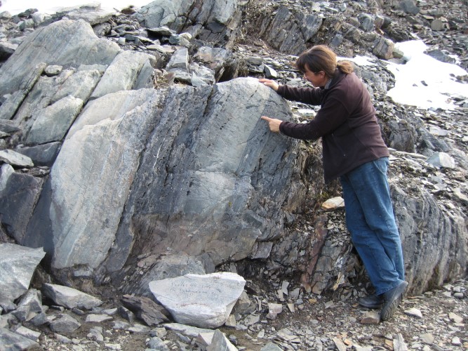
Humans have exploited geological resources in Greenland throughout the country’s 4,500-year cultural history. Rock crystal, diabase, quartzite and soapstone are found in all parts of Greenland and have been used as tool materials by all Inuit cultures. Soapstone was also mined by the Norse, who left runic inscriptions in soapstone quarries along the west coast.
Killiaq is a fine-grained, slate-like, volcanic rock found on Nuussuaq and on a small island in Qeqertarsuup Tunua (Disko Bay). Tools made of Killiaq from both the Greenlandic Stone Age cultures, Saqqaq and Dorset, are known from virtually the entire West Coast. Killiaq has clearly been traded as a semifinished product and is an example of organised extraction of special raw materials.
The people of the precolonial Inuit culture extracted Telluric (terrestrial) iron from some, globally, extremely rare natural deposits in basalt on Qeqertarsuaq, and at Cape York, meteoric iron was extracted and cutting edges were made for knives and harpoon tips by cold forging.
Since the colonisation in 1721, focus has been on exploiting Greenland’s natural resources. Initially, it was mainly oil from seals and whales, but over the centuries, the mineral resources increasing became the object of interest. Shortly after his arrival, Hans Egede reported deposits of the then very expensive mineral graphite. In 1852, mining of copper ore started at Alanngorsuaq Fjord (Coppermine Bay), south of Arsuk, but mining was quickly abandoned. In 1905, they tried again, now with smelting works, but gave up again in 1914.
In recent times, there have been several more or less successful mining projects. At Maamorilik in the Uummannaq Fjord, 11 million tonnes of lead and zinc ore with a grade of 14.3 % zinc, 4 % lead and 29 g silver per tonne were extracted during the period from 1973 to 1990.
An iron deposit at Isua near Nuuk, a large zinc deposit at Citronen Fjord in North Greenland and a number of deposits of molybdenum, platinum metals and gold have been investigated on the east coast, but have not yet been profitable.
Cryolite – Greenland’s biggest mining success
In the area near Arsuk, a so far unknown chalk-white mineral was found in the 1770s, which in 1779 was described and named cryolite – ‘ice stone’. It became the mission of Greenland’s biggest mining success, and one of Denmark’s biggest industrial adventures. The industrial magnate C.F. Tietgen and the chemist Julius Thomsen started the exploitation of the cryolite deposit at Ivittuut in 1854 – with a view to producing soda and enamel. It was soon discovered that cryolite could be used as an excipient in the production of aluminium, which until then had been more expensive than platinum and gold. By using cryolite in the process, aluminium became cheaper than copper, and thus it became available as a utility metal. Greenland dominated the cryolite market until the deposit had been depleted in 1987, by which time more than 3.5 million tonnes of cryolite had been mined.
Access to the strategically important cryolite was a contributing factor to the American presence during World War II, when the income from cryolite paid for Greenland’s supply of goods.
Extraction of uranium, thorium and rare earth elements
The area around Narsaq in South Greenland has had almost mythological status for almost 150 years. The area has some very unusual rocks, which contain very rare or unique minerals and have high content of a number of elements, such as uranium, thorium and the rare earth elements (REE), which are otherwise largely absent in ordinary rocks.
In 1956, Niels Bohr proposed that uranium from Kuannersuit (Kvane-fjeld) could support Danish nuclear power, and a major exploration effort was launched. Towards the end of the century, REEs became important metals because they are used in many electronic components and in components for green energy production. This meant renewed interest in the area with two potential projects; one for the extraction of REE and zirconium, and one for REE, uranium and zinc. The uranium deposit has a relatively low grade but is a very large overall resource. Throughout the project’s almost 70-year lifespan, the issue of uranium extraction, based on both environmental and political considerations, has given rise to a, at times, heated debate in Greenland.
The possibility of oil and gas extraction
Greenland is considered to have a potential for oil and gas roughly equivalent to the amount extracted in the Danish part of the North Sea. Deposits to that extent would have a significant effect on Greenland’s economy, but so far no actual discoveries have been made. With an increasing shift in the energy market from oil, gas and coal to renewable energy sources, and a time horizon of decades from a possible discovery to production, it is doubtful whether there will ever be oil or gas production in the country.
Extraction of mineral resources
Extraction of mineral resources in Greenland is regulated through extensive legislation. This will reduce the negative societal or environmental impact of the exploitation of geological resources. Therefore, there is reason for being optimistic that the nascent mining industry can make a positive contribution to the development of the Greenland society.
Ikaite columns at Ivittuut
RICHARD MARTIN, 1995
In many places in Greenland, unusual geological formations can be found that have been exploited locally as raw materials. One example is the now closed mining settlement of Ivittuut where cryolite, together with a number of other rare minerals is embedded in granite formed more than 1 billion years ago.
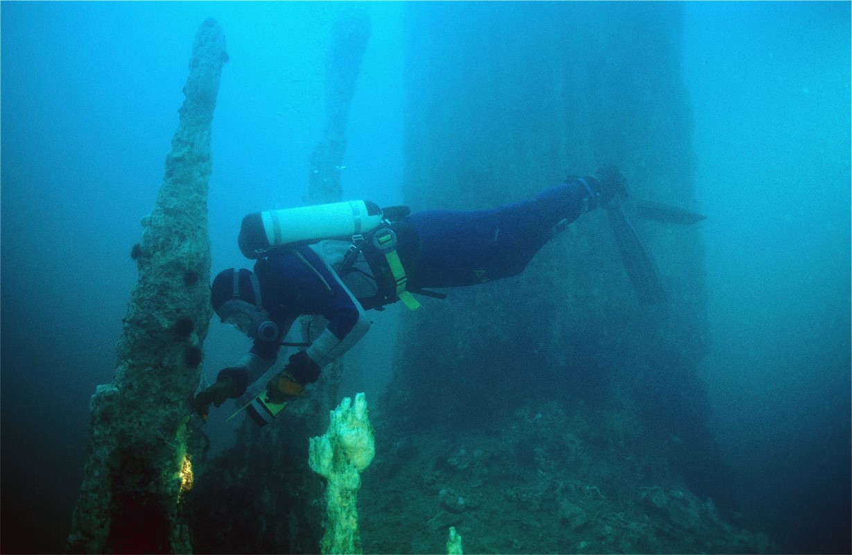
In a nearby fjord, it has caused the leaking groundwater to form giant submarine columns made of the rare calcium carbonate mineral ikaite. Within a very small area, hundreds of columns up to 20 meters high »grow« from the seabed. Since 1995, a number of interdisciplinary studies have been conducted to shed light on this unique natural phenomenon.
Further reading
- Agriculture in Greenland
- Coasts
- Greenlandic gemstones
- Industry and labour market
- The ice-free landscapes
- The ice sheet
- The sea and the fjords
- Towns and settlements
Read more about Nature and landscape in Greenland

