BO ELBERLING, 2016
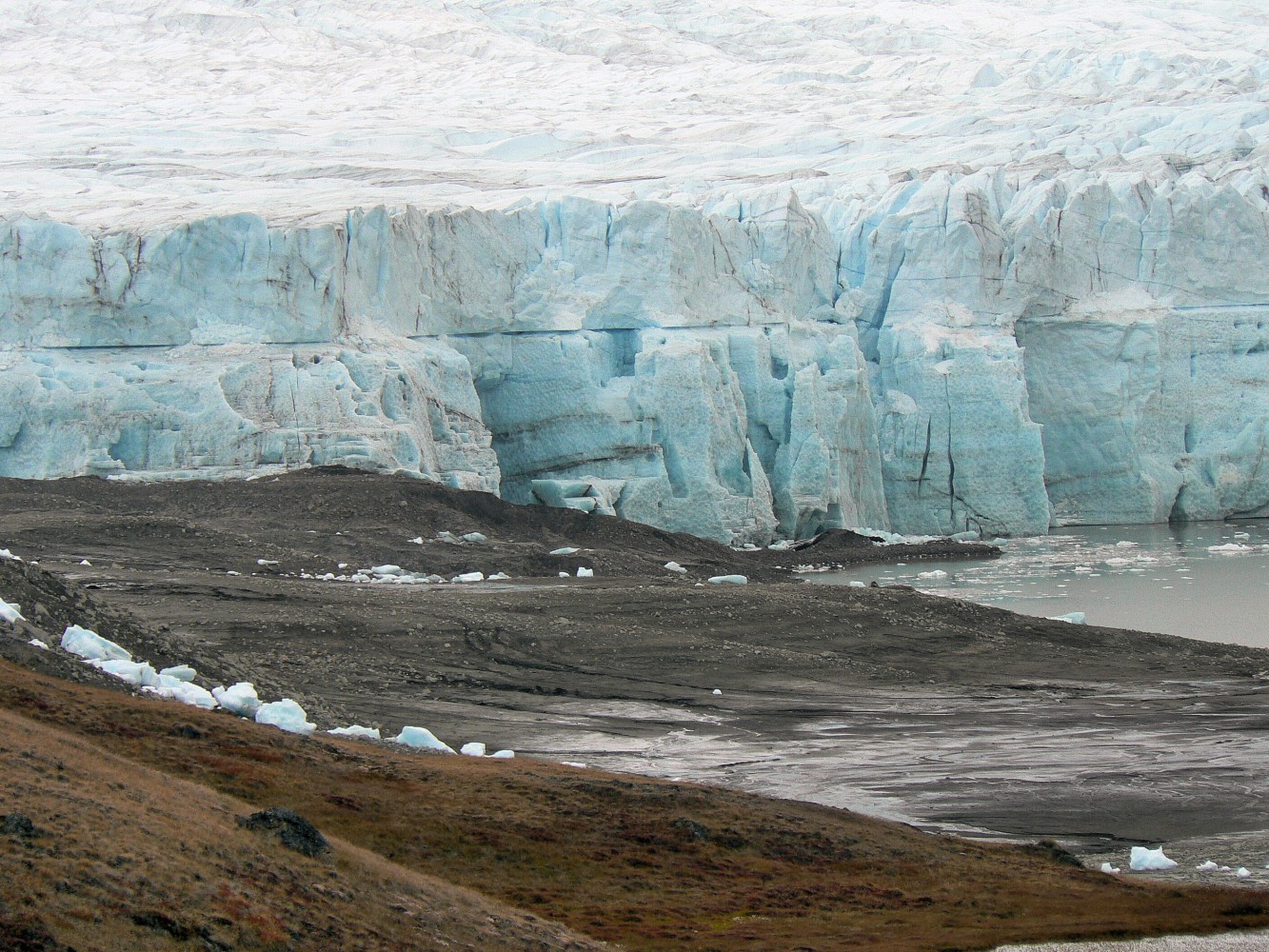
Greenland has vast areas of fresh water. Water cascades from rock walls, accumulates in streams, ponds and large lakes and eventually flows into the sea. All year round, estuaries with red, brown and clear water supply enormous amounts of fresh water to the sea. Melting from the many glaciers in summer and precipitation throughout the year are the direct cause. A network of streams has formed over time in valleys and on plains where precipitation and meltwater accumulate in small streams which in turn join into large rivers, which flow into the sea.
Many rivers and streams run through more stagnant waters and form a number of freshwater ecosystems along the way. These include mires, ponds, lakes and river basins, each of which is characterised by physicochemical conditions that in turn provide the basis for a special composition of plants and animals.
Due to widespread permafrost and bedrock, water seepage is limited in many places, which increases the near-surface runoff and means that groundwater is largely absent. Accordingly, water accumulates on the surface and constitutes a significant element in the ecosystem.
The fresh waters are affected by the climatically determined runoff of meltwater from snow and ice and its content of suspended mineral particles and dissolved inorganic salts. Organic material from plants and microorganisms can also be added in areas with vegetation that are adjacent to lakes and streams. Overall, however, freshwater systems are typically nutrient deficient. This generally means that freshwater systems are frequent and constantly affected by the weather, the shape of the landscape as well as the processes that occur in the landscape.
Homeothermic springs
Some very unique ecosystems can be found in and around homeothermic springs, which are known from several places in Greenland such as Uunartoq and at Qeqertarsuaq (Disko). Green vegetation is present all year round and it is possible to find rare plants like orchids. Some springs are only a few degrees warm, while others reach higher temperatures and are used by locals and visitors as ‘hot baths’.
Salt lakes
Another unique type of freshwater is lakes with a high saline content, which have formed because the land has risen after the last glacial period that former old lacunae have been cut off from the sea. Other salt lakes have formed because meltwater with a high saline content is continuously being led to the lake and because water evaporates from the surface at the same time.
Marshland
The rivers that flow into fjords and along coasts often form large delta areas (marshland) that serve as a transition zone to the marine ecosystem. The marsh is an extremely dynamic environment with repeated floods and deposits from a large catchment area. It provides a food base for waders that migrate to Greenland from e.g. Europe, and is a pantry for seabirds and fish. Even land animals, such as foxes, are attracted by the availability of food. Seen from a larger perspective, freshwater ecosystems make up a considerable part of Greenland’s nature and therefore play a major role in the ecological cycle.
Freshwater flora and fauna
The biology of Arctic lakes and streams differs from lakes in many other climatic zones by having a short growing season of a few months. The growing season is considered to be the period when the water is warm enough for animals and plants to grow and multiply. Winter is a long period with very little light because there is a thick layer of ice and snow on top of the water. Towards the bottom, however, the temperature rises and the temperature may be 2‑4°C, while it is 0°C just below the ice. North of the Arctic Circle there is no light at all for a few months, since the sun is constantly below the horizon. The ice thickness typically reaches 1 to 2 m, meaning that very shallow lakes and ponds freeze solid during winter. Lakes with greater water depths (more than 3 m) will never freeze solid and therefore allow animals and plants to survive without going into hibernation. The thickness of the snow layer varies depending on the snowfall and the wind conditions.
The concentration of nutrients is often quite low, since the incoming water mainly comes from melted snow and ice. The meltwater can also transport silt (glacial flour) and soil from the surrounding area, making the water turbid.
Despite low temperatures and poor light conditions, plants and animals are active long before the ice melts. The intensity of sunlight increases significantly during spring (March to May), meaning that sufficient light can penetrate the snow and ice layer and thus kick-start photosynthesis. The amount of phytoplankton increases with the intensity of the light during these months despite low water temperatures. When the ice has melted and there is full sunlight, the growth of phytoplankton often stagnates because the nutrients are depleted.
Food chain in lakes
The food chain in the Greenland lakes is short and consists of a grazer food chain where phytoplankton is eaten by zooplankton (daphnia and copepods), which are themselves the prey of invertebrates (e.g. beetle larvae) and fish. There is also a degradation chain where the organic substances produced by algae and from animals that eat algae or each other are consumed by bacteria. The decomposers themselves are eaten by single-celled animals (protozoa), which in turn end up as food for daphnia and copepods. This closes the cycle and only a small part of the production ends at the bottom. Nevertheless, an active food chain can also be found at the bottom, including bacteria, unicellular organisms, chironomid larvae, flies and beetles as well as tadpole shrimp, an ancient crustacean order, which feed on the material that sinks to the bottom.
The key component in the lake bed, however, is the ‘algal mats’, which are millimetre-thick complex layers of algae and bacteria. The algal mats can cover large areas of the lake bed. An important component of the mats are filamentous blue-green algae that are able to bind nitrogen, which is of great importance in an otherwise nitrogen-deficient environment.
Another type of blue-green algae group, which belongs to the genus, the cynaobacteria Nostoc, forms spherical colonies that can grow to a considerable size. They are popularly referred to as sea tomatoes and can reach a considerable age because they grow slowly and have no enemies. On the other hand, the algal mats are a source of food for the benthic animals, but actually also for the zooplankton species from water bodies, which get a valuable food supplement on the lake bed by ‘grazing’ on the mat surface.
The tadpole shrimp (Lepidurus arcticus) is an interesting animal because it is so well adapted to Arctic life. It can be found both in the water body and on the bed. It is omnivorous and does not mind eating members of its own species.
Organisms in streams
The streams generally do not offer living ground for many types of organisms because of the considerable differences in the rate of flow throughout the season. In spring, the water flows rapidly, making it difficult for animals and plants to find a stable habitat. Nevertheless, chironomid larvae and flies can be found in the bottom layer and on the underside of rocks. The benthic organisms in lakes, ponds and streams are important prey for fish, and when aquatic stages of chironomid larvae and other insects hatch into flying adult stages, they provide food for many bird species.
Aquatic plants
Mosses are frequently seen at the bottom of lakes, ponds and streams with clear water, but Greenland does not have many species of actual aquatic plants, and often only a few species dominate a lake. Most hydrophytes, apart from the mosses, have floating leaves or other types of aerial leaves. This increases the uptake of carbon from the air, as fresh water in Greenland is very low on bicarbonate, which is the carbon source of plants. The most common species are pond weed (Potamogenton sp.), mare’s tail (Hippurus vulgaris), water-starwort (Callictriche sp.) and bur-reed (Sparganium sp.). In the northernmost part of Greenland, you usually only find mosses.
Freshwater fish

KIRSTEN S. CHRISTOFFERSEN, 2010
The Arctic char (Salvelinus alpinus) is Greenland’s most common freshwater fish. Its habitat is lakes with a water depth of more than 4‑5 m, since the ice layer otherwise does not provide enough space and especially not enough oxygen for the fish to survive. It is not uncommon to find several variations of Arctic char in the same lake. There can be both a migratory population if the lake has access to the sea via a river, and a stationary population, which in turn can consist of two forms. The migratory form can grow up to 60‑70 cm and spends several months in the sea where it eats a lot of food so that it can swim back to the lake where it originally came from to spawn.
The two non-migratory forms are shorter and more slender, which is most clearly seen in their dwarf form, being only about 15‑17 cm when sexually mature. The different forms are the result of the scarcity of food in the lakes.
Although the occurrence of Arctic char is often sparse, they have a great impact on the volume and composition of zooplankton and tadpole shrimp in the lakes. It is generally an ‘either-or’ situation; when Arctic char are present, there are no large daphnia and only very few and small tadpole shrimp.
Salmon (Salmo salar) is common in the sea around Greenland but only breeds in the river at Kapisillit – which means salmon in Greenlandic – in the innermost part of Nuup Kangerlua (Godthåb Fjord). The salmon here has probably been isolated for many thousands of years and is genetically very unique. Unlike Arctic char, salmon roe requires relatively high temperatures to develop. In the river system at Kapisillit, a number of small shallow lakes can be found which are relatively easily warmed by the sun in summer, and this probably explains the occurrence of salmon in this area.
Birds of freshwater systems
Birds associated with the freshwater systems especially include geese, which use lakes and delta areas during the period they spend in Greenland to breed and moult. In some areas there can be so many geese that it reduces the vegetation cover and at the same time, nutrients are supplied via goose droppings to the lakes. Other common bird species at lakes are common loon, common goldeneye and red phalarope, most often with just one couple per lake.
Floods and emptying of glacial lakes

OLE GEERTZ-HANSEN, 2007
The water level in the rivers is at its highest when the snow melts in spring, during heavy rain showers and when high air temperatures cause massive and rapid melting from glaciers and ice sheet. It is called an outburst flood when the water levels and runoff are extraordinarily high and the water can flood land areas and cause great damage to roads, bridges and buildings.
Kangerlussuaq and Qeqertarsuaq are places where heavy rain and rapid melting of snow and ice have created large outburst floods. In July 2012, the road between the two bridges crossing the Watson River in Kangerlussuaq was washed away by the water masses, and in 2014, the Røde Elv (Red River) in Qeqertarsuaq ran on both sides of its bridge after heavy rainfall.
In Narsarsuaq and at the research station in Zackenberg, outburst floods are seen in connection with a sudden emptying of lakes dammed by glaciers. Along the edge of the ice sheet and large glaciers lie lakes that are dammed by ice. When these lakes become too large, the water pushes its way out under the ice and empties into the river in an outburst flood. The same process is repeated at yearly intervals.
Drinking water supply
Most towns and settlements use water from lakes and rivers for drinking water after it has been filtered and UV-purified or chlorinated. In the towns, water can be used directly from the tap, but in many towns and settlements, the citizens have to fetch water for the household from a tapping house.
North Greenland is very dry and cold in winter, and the surface water freezes solid, making it impossible to get water from lakes and rivers. In areas with insufficient surface water to supply citizens and industry, drinking water is made by desalinating seawater and melting growlers. In a place like Qaanaaq, this can lead to problems maintaining a good water supply during the winter period.
All lakes and rivers used for drinking water are protected by a water barrier zone, an area where activities are regulated.
Hydropower
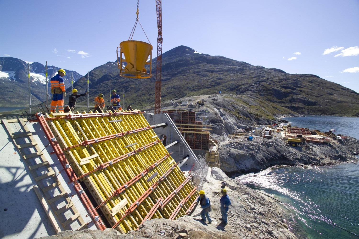
In areas where water flows down from great heights in the terrain, it can be used for hydropower. Five hydropower plants generate electricity for six of the largest towns in Greenland. In 2018, they covered 67 % of the electricity consumed by citizens and industry.
The largest and oldest hydropower plant is Buksefjorden, which supplies electricity to Nuuk. The supply cable that carries electricity from the power plant to the town stretches over 58 kilometres and crosses, among other things, the huge Ameralik Fjord south of Nuuk. Here, the cable runs from a mountain top on one side of the fjord to a mountain top on the other, and at 5,376 metres, it is the longest freehanging high-voltage line in the world.
Monitoring the hydropower potential

IVARS SILIS/NUKISSIORFIIT, U.Å.
Hydropower is only used to a limited extent today, and it has great potential. However, hydropower has a great impact on nature, which must be held up against the benefits of security of supply and affordable green energy. The hydropower potential has been monitored since the 1970s, and provides valuable information about how much meltwater is formed from the ice sheet from year to year. The fresh water bodies are also monitored in terms of volume and content of various nutrients and thus also the nutrient supply to the many fjords.
Water volumes are monitored in many places in order to gain insight into how much water is flowing past the potential hydropower plants. Asiaq – Greenland Survey undertakes these surveys on behalf of the Naalakkersuisut (Government of Greenland). Asiaq has 21 active survey stations on the west coast from Qasigiannguit in the north to Paamiut in the south where precipitation and melting glaciers produce vast amounts of water in the rivers. In addition, several survey stations are operated by research projects, including the Zackenberg River in Northeast Greenland and the Watson River in Kangerlussuaq.
Pollution and wastewater
For people living along the coast, wastewater is led directly to the sea by way of pipelines or ditches. The settlements and parts of the towns have no sewage system, so here toilet waste is collected and emptied into the sea, while the grey water (kitchen and washing) is discharged into ditches and drains or to the ground. In some places, this can result in eutrophication (nutrient load) of suburban lakes.
Nalunnguarfiup Tasia lake in Sisimiut is an example of a place where seepage from the surrounding buildings and keeping of dogs have given rise to large amounts of filamentous algae.
Considerable amounts of fertiliser are used for agriculture in South Greenland, and leaching of nutrients to the streams causes local eutrophication phenomena such as the presence of filamentous algae in the streams.
Mining

OLE GEERTZ-HANSEN, 2017
The only industry in Greenland that makes discharges to freshwater systems is the mining industry. Most of the debris from mines consists of waste rock, i.e. rock that must be removed to get to the ore, and ‘tailings’, i.e. remnants of the crushed ore once the saleable minerals have been extracted from the ore.
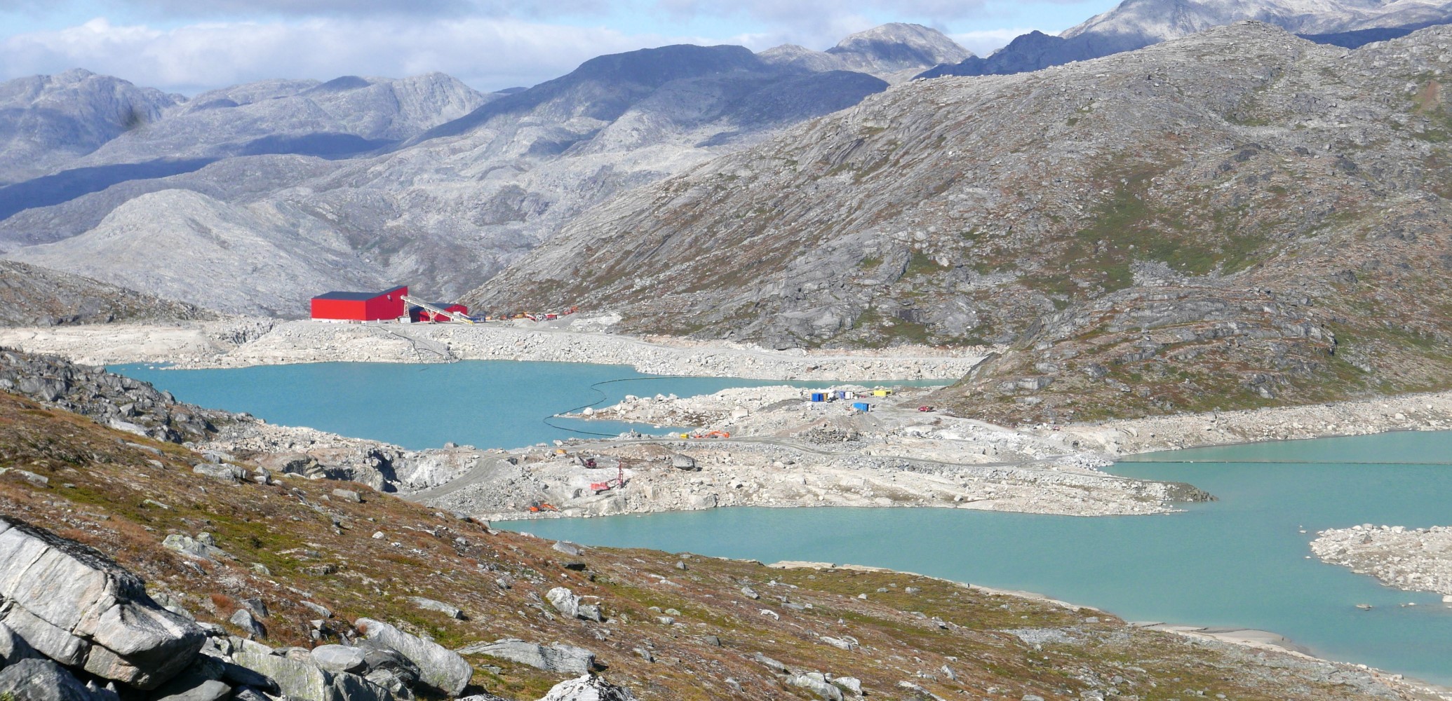
Waste rock and tailings are often deposited at the bottom of freshwater lakes since this reduces the release of mainly heavy metals compared to deposit on land. The actual discharge of tailings and waste rock in lakes causes reduced visibility due to finegrained suspended material. Once the material has sedimented, further degradation and release of unwanted substances occurs slowly. In addition to waste rock and tailings, there may be discharges of process chemicals from the processing of the ore and of wastewater from the mining town.
One example is the gold mine at Nalunaq, closed in 2013, where gold was mined using e.g. cyanide. During mining operations, measurements showed slightly elevated values of a number of substances such as cadmium in water and trout in the nearby river. However, four years after the closure, levels were back to normal.
The ruby mine near Qeqertarsuatsiat is another example of a mine located on the shores of a lake where the water level has been lowered 10 metres and where waste rock and tailings are being deposited in the lake causing slightly elevated levels of some metals and reduced clarity in the lake.
The mining industry has its own set of laws and executive orders, which set out recommended thresholds for a number of substances in the discharge to freshwater systems. Modern mining industry is relatively new in Greenland, and environmental regulation is still being developed.
Further reading
- Agriculture in Greenland
- Biodiversity and nature management
- Bird species in Greenland
- Coasts
- Geology in Greenland
- Horticulture
- Industry and labour market
- Seasonal pollution in Northeast Greenland
- Systematic environmental monitoring
- The climate in Greenland
- The ice sheet
- The ice-free landscapes
- The sea and the fjords
- Towns and settlements
- Tree planting in Greenland
Read more about Nature and landscape in Greenland

