ARAT KROON, 2013
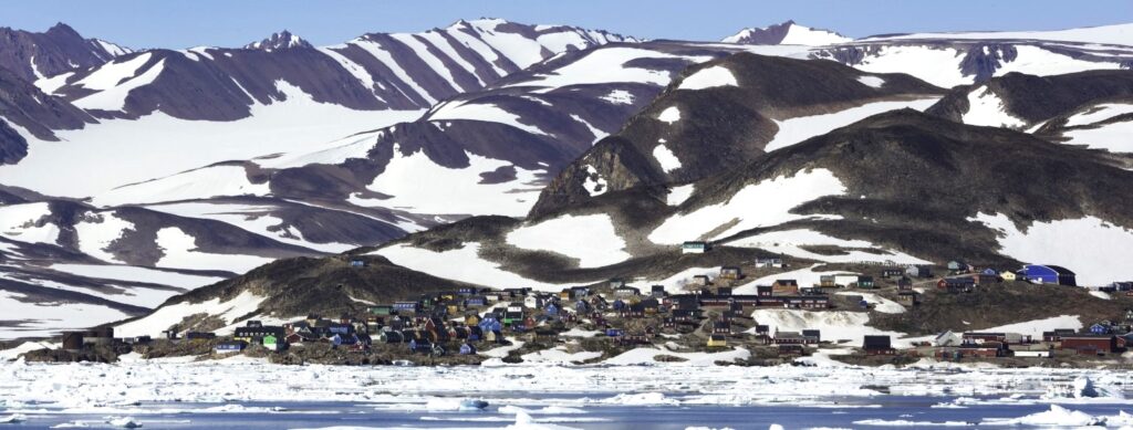
Greenland is dominated by an about 44.000 km long coastline between the ice sheet and the sea. Most human activity takes place near the coasts. Most towns and settlements are located directly on the water where important industries such as hunting and fishing have easy access to open water. However, most of the coastal areas are uninhabited, which has created space for natural coastal development where coastal processes have been able to run their natural course.
The coasts are dominated by deep fjords where sedimentary deposits such as beaches, alluvial cones and deltas are common, and which primarily originate from a sediment supply from rivers and streams. In the catchment area, weathering has broken down rocks into small particles that can be transported to the shores by wind and water. In addition, the rivers erode and transport sediments on the way to the shores. Deltas form near the mouth where the valley system flattens, the flow of water decreases and sediments therefore deposit.
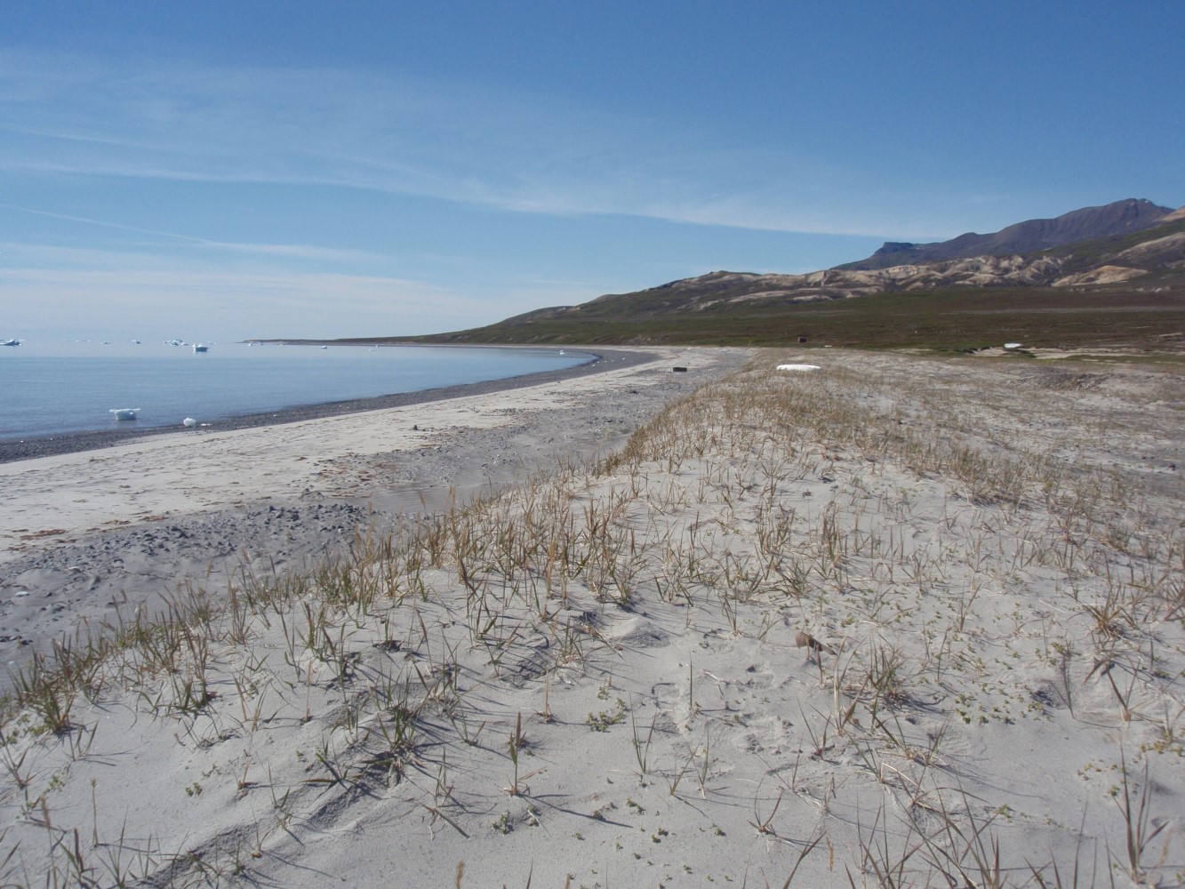
Most of the coasts are rocky coasts where coastal processes such as waves and tides have a relatively small impact in terms of changing the shape of the coast. Waves, however, affect rocky shores through breaking and erosion of the rocks, but it is a slow process, and even over decades, no major changes can be observed in coastal areas with rocky shores. A small part of the coasts are sedimentary coasts with beaches where loose sediment can be eroded, transported and rearranged by coastal processes associated with waves, tides and wind. This article mainly focuses on this type of coast.
Greenland’s coasts are unique. There are not many places in the world where the sediment supply from the glaciers to the coastal areas takes place over such short distances as between 10 and 50 km. A number of conditions specific to the Arctic affect the coast. The two primary conditions are sea ice which dampens coastal activity and permafrost which reduces erosion. Both are affected by the ongoing climate change and may lead to increased sediment supply and coastal activity.
Sedimentary shores and coastal processes
Sedimentary shores are found where sedimentary deposits are eroded, creating new landscapes such as deltas, barriers or beaches. New deltas are formed along coastlines with large sediment supply, and a distinction is made between: deltas exposed to wind and waves from different directions and deltas at the head of fjord systems with limited exposure.
In the case of exposed deltas, the coastline is affected by wave processes. Deltas with limited exposure to wind and waves are dominated by river runoff, while the wave impact along the delta front is very limited. Barriers and beaches are being created under the influence of waves where the sediment sources originate from eroding cliffs, sediment-bearing rivers and sediment transport from coastal, low-water areas.
Waves, tides and ice

NASA, 2006
The processes that affect the sedimentary shores are primarily controlled by waves, tides and ice. The wave impact in the fjord systems is local. The free stretch, wind speed and wind duration determine the wave height, which is a measure of how much energy is available for erosion, transport and sediment deposition.
The free stretch is often limited to a few kilometres, meaning that the wave height in a fjord rarely exceeds 1 m – even during a storm. The wind in the fjord systems is often controlled by the local topography where the wind accelerates when it is forced into the fjord. This affects the wave activity, and the highest waves are created in continuation of the fjord orientation and beaches with considerable rebedding of sediments are formed at the head of the fjord.
On exposed coastlines with open sea, swells originating from wind fields outside the coastline in question play a significant role. When the waves hit the shore at an angle, a transport of sediment is generated along the shore, which can lead to the formation of recurved spits or barriers. Along delta fronts, waves often create bars and redistribute sediments transported via delta flows. When a delta channel changes, it often means that no sediment is added to the old delta flow and it is being eroded, while the active delta flow receives sediments that accumulate. To this should be added the impact of tides, which means that the wave energy is distributed differently during low or high tide.
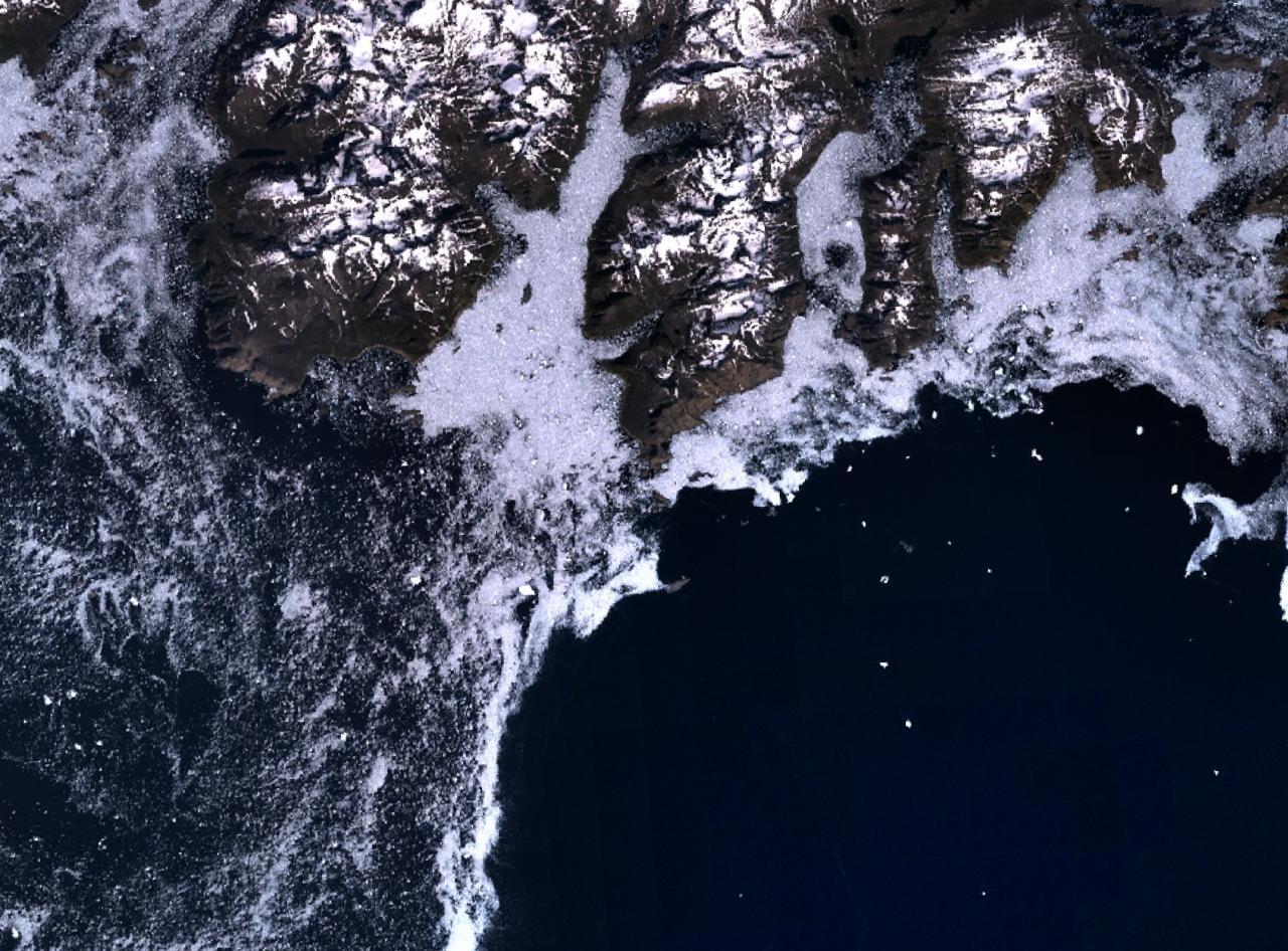
The ice has both a direct and an indirect impact on the coastal areas. The ice dampens waves and thus reduces the intensity of the processes along the coasts. When the ice melts, wind and waves can transport drift ice toward the shores, affecting the shores directly by pushing ice and sediments onto the beach.
Short-term coastal changes
Extreme events often have a major local impact on the coasts. Storms in coastal areas have two direct impacts: the wave height, and thus the wave energy, increases and the water level rises.
The rising water level is mainly a consequence of the wind. High water levels and increased wave energy create storm deposits on the beach, which can be seen as storm ridges as well as erosion along the cliffs. The sediments in these storm ridges are often gravel and sand. Large rocks on beaches have often been eroded directly from a cliff, while the smaller particles have been carried away. Some large stones may be ice-rafted debris, which have come with icebergs and left behind when the ice melts.
Extreme events on the coasts are seen in connection with landslides, calving icebergs or earthquakes. This can create a tsunami wave, which can grow several metres high along shallow coastlines and flood coastal areas.
In relatively small fjord areas, this type of wave often reflects on the opposite side of the fjord and resonates in the basin.
Long-term coastal changes
Long-term processes that affect sedimentary shores play a role on time scales from decades to millennia. Relative sea level changes are defined as the result of vertical changes in the water level (eustatic changes) and vertical changes in the land crust (isostatic changes).
Water level rises are directly controlled by melting from ice caps and heat expansion of the seas by heating. Land uplift occurs when the ice melts (glacioisostasy), relieving the pressure on the land. In general, there is a north-south gradient in Greenland where the southern areas have generally experienced a relative fall in sea levels during the first part of the Holocene epoch, followed by a relative rise in sea level in the past period. In the northern part of the country, a relative fall in sea levels has been observed throughout the Holocene. In addition, the gradient is often strong in the relative sea level from the inner fjord areas close to the ice caps to outer fjord areas close to the open sea, where the ice caps have melted away over a long period of time.
Relative sea level changes have been explored and studied on many Greenland coastlines. In areas with a relative fall in sea levels, coastal deposits can be seen to lift up slowly. This means that old beach ridges, an indicator of old beaches, are located high up in the landscape in relation to the current beach and the current sea level. Dating of beach ridge systems at different levels above sea level has been used to reconstruct relative sea level changes at different coastal locations, and these sea level curves are used to reconstruct climate change back in time.
Beach ridge systems have been a typical home for the early cultures. Often they consist of gravel and sand that drain the water efficiently and are less sensitive to permafrost. Archaeological finds and settlement structures are often associated with beach ridge systems where the oldest culture lies highest in the terrain.
Further reading
- Geology in Greenland
- Industry and labour market
- The climate in Greenland
- The fresh waters
- The ice sheet
- The ice-free landscapes
- The polar bear
- The sea and the fjords
- Towns and settlements
- Whale species and whaling
Read more about Nature and landscape in Greenland

