GRØNLANDS STATISTIK
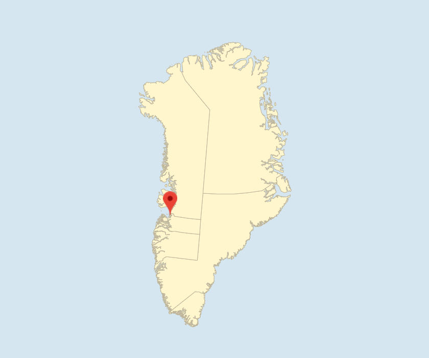
Qasigiannguit with 1,071 residents (as of 1 January 2021) is located at a small bay in the northeast corner of the Sydøstbugten in Qeqertarsuup Tunua (Disko Bay). The nearest settlement is Ikamiut with 78 residents.
Qasigiannguit means ‘the small common seals’ and is probably named after the breeding and shedding ground of the common seal on the sandbank at the head of the bay.
History of Qasigiannguit
The colony was established in a small southward cove in 1734 by the trading company of Jacob Severin and was named Christianshaab after the current King Christian VI. The establishment of the colony was an attempt to keep Dutch whale hunting and trade with the population under control and also to spread the mission to North Greenland.
The early colonists named the cove Bryghusbugten, a name that is still used to this day. The bay called Vierrebay by the Dutch was marked as an anchorage on Dutch nautical charts of the Davis Strait from the early 18th century when the Dutch engaged in extensive whale hunting.
In the period 1734 to 1740, Hans Egede’s son Poul Egede stayed in the colony for a total of four years, during which period he laid the foundation of a Christian congregation.
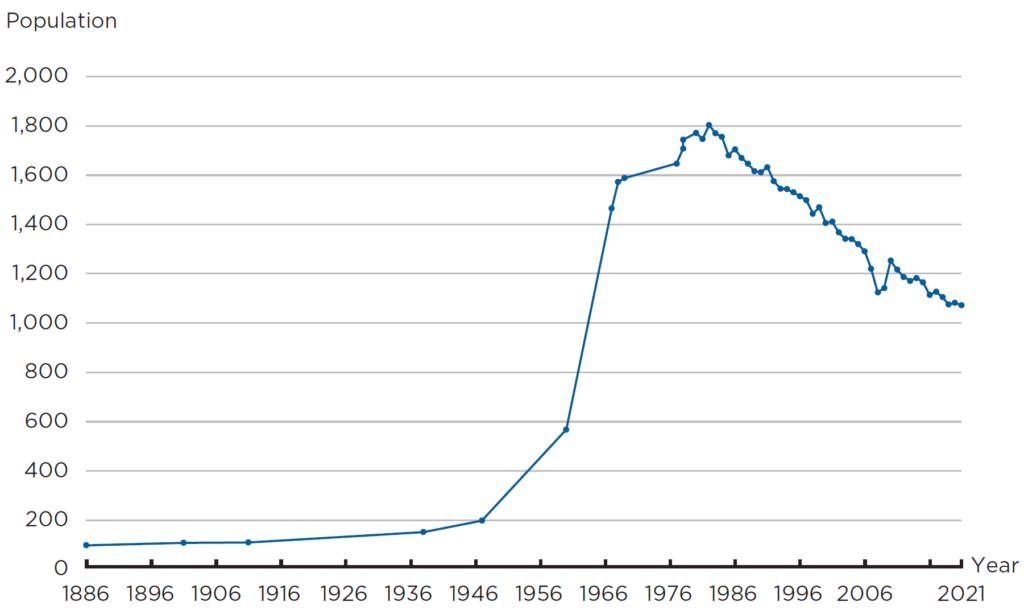
The location in Bryghusbugten was abandoned after a few years. The colony was moved to the opposite side. A new farmhouse was erected, but the old farmhouse was later moved to the same location. The old houses with their exquisite Nordic building style became the centre of the small colony, which only expanded slowly in the first two centuries. The population was less than 100 people all the way up to the early 20th century.
The families provided for themselves by hunting and fishing, supplemented by collecting eggs and small secondary income from selling lingonberries that are common in the area. Up until World War II, development in trade and industry was slow, despite random new initiatives involving e.g. hunting and fishing using nets.
Development, trade and industry and infrastructure of Qasigiannguit
The localisation of major shrimp fields in Qeqertarsuup Tunua in the late 1940s set the development in motion in the following decades. Despite production being at a standstill during months of ice formation, the Royal Greenland Trading Department (KGH) set up a modern shrimp production facility in the town. Local families invested in shrimp cutters that often also had harpoon guns for supplementary whale hunting, and fishing families from outside the town and seasonal workers moved to the town over time.
The town rapidly became a modern town with a significant population growth, where most people worked in shrimp fishing and shrimp production and related industries. The factory meant that the town had water supply and electricity early on.
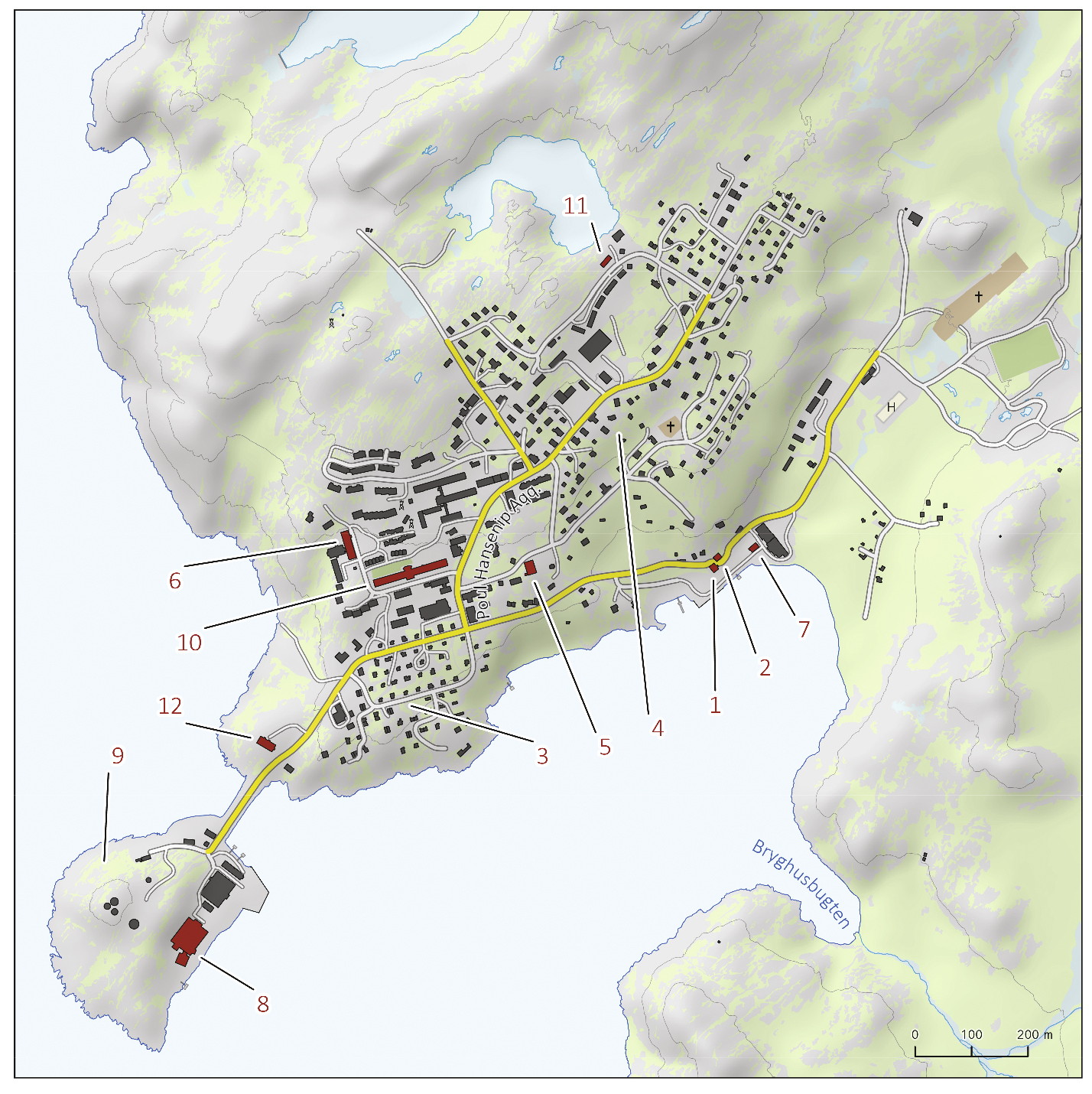
The residential neighbourhoods with the distinctive GTO housing benefit houses started shooting up in the Quikoq neighbourhood to the south and Illoqarfittaaq to the north, and multi-family homes, blocks of flats and terraced houses were built for newcomers. The road network was expanded in a south- to northbound road network in three levels connected by the main road Poul Hansensvej.
With the population growth came the new church Paaviap Oqaluffia, a hospital, a dental clinic, children’s institutions and a modern multi-track school with dorms for the children from the settlements in the district. Athletic activities, cultural life and voluntary association activities blossomed in those years.
When shrimp production moved to neighbouring towns and the Qasigiannguit factory was converted to process Greenland halibut and other fish species shortly before the 2000, the town changed character and a systematic reorientation has since been underway. The production facility in the inner harbour was demolished and the area is now used by dinghy fishermen and recreational sailors. A dinghy repair workshop has been built on the old waterfront.
The town’s activity centres are now located in the town centre, Royal Greenland’s production facility and the Royal Arctic Line’s port are located on the island of Quilik. The change in production lead to a drop in the need for labour, leading to a noticeable outward migration from the town. The population of 1,071 is nearly half that of the blooming population of the 1980s where it peaked at 1,803 in 1982 and is considerably higher during the peak season of the shrimp fishery. With the outward migration, the largest housing blocks became vacant and were converted into institutions, such as the national Villads Villadsen continuation school and the Puilasoq orphanage.
Public transport is seasonal; during winter, neighbouring towns can be reached by helicopter, during summer, they can be reached by passenger ship, which departs daily during the peak season. In recent years, travel options have been supplemented by small private vessels.
Most people work in public administration and service, in the service sector and in private businesses, primarily construction, many work at Royal Greenland’s production plant and as fishermen and hunters. The tourist industry is growing: The quiet small-town atmosphere is an attraction and also offers great excursions both on land and water.
Qasigiannguit mainly receives supplies from Royal Arctic Line’s ships that call on the town once a week from April to December. Grocery trade is mainly undertaken by Pilersuisoq (KNI), which operates in Greenland’s small towns and settlements. Taking into account the size of the town, it even has a strong tradition of a small private businesses. Electricity is supplied by Nukissiorfiit through a combined heat and power plant. The plan is to establish a hydropower plant in the district in the coming years. Telephony and Internet are provided by Tusass (formerly Tele Post Greenland) via a high-speed radio link connection to Aasiaat.
Most single-family homes have their own oil burner. The town’s water supply comes from surface water from water lakes east of the town, and institutions as well as a large part of the town’s housing have running water, while most other housing either have a water tank or get the water themselves. The town has a sewer system, but it has not been extended to cover all private homes, so many still have toilet buckets with biobags or a sludge tank. Waste management is carried out from unsorted waste bins and the town still has an open dump (waste landfill) with some degree of sorting under the inter-authority waste company, ESANI a/s.
The waters consisting of short fjords and many small islands are calm, and many people enjoy fishing in summer, hunting and berry-picking as well as camping in tents or staying in summerhouses. In particular, the abandoned settlement of Akulliit has many visitors, and during the high season it almost becomes repopulated. Fishing is mainly for capelin, trout and cod, and birds, seals and small whales are hunted for own consumption.
Historically, Qasigiannguit has a relatively dry climate. Summers are warm with an average temperature for July of 9 ºC, spring and autumn are short, and the cold winter transitions into the special North Greenland sunny and frosty months from March to May. The prevailing wind direction is from NNE. However, Qasigiannguit is known for the strong Saqqarsarneq foehn from SE, which at short notice in both summer and winter roars down from the Qaqqarsuaq mountain, causing temperatures to rise by several degrees in just a few hours. In recent years, weather has been characterised by more humidity and more frequent storms, and winter ice forms less often.
The town lies beneath the Qaqqarsuaq massif with direct access to the hinterland’s rounded mountains and wide stretches of lush valley and lake systems that are perfect for hiking. In winter, it provides the perfect conditions for dog sledding or snowmobiling along the traditional winter roads. The sled trails lead south into Sydøstbugten and north to Ilimanaq and the southern branch of the ice fjord, Tasiusaq, and they are used as soon as it is possible for hunting and fishing as well as outdoor activities and tourism.
ASIAQ, 2022
Further reading
- Aasiaat
- Association activities and volunteering
- Hans Egede and the work for the mission service
- Housing
- Industry and labour market
- Kangaatsiaq
- Kommune Qeqertalik
- Population and demographics
- Qeqertarsuaq
- Towns and settlements
Read more about the Municipalities and towns in Greenland