MAP BY PER JØRGENSEN GADS FORLAG, 2017, DANMARK OG KOLONIERNE: GRØNLAND – DEN ARKTISKE KOLONI
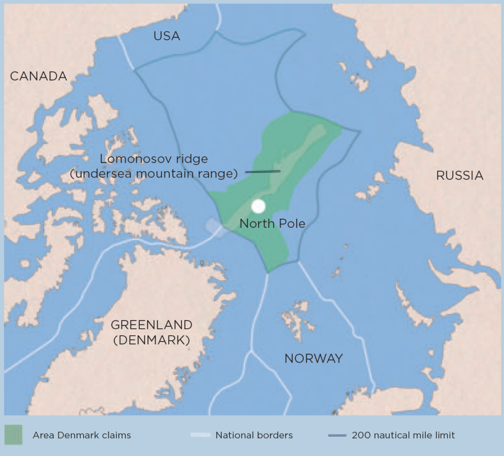
Launched in 2002, the continental shelf project is to document the Unity of the Realm’s rights to the seabed and thus the right to exploit the resources that lie further out than the exclusive economic zone of 200 nautical miles.
Denmark ratified the UN Convention on the Law of the Sea on 16 November 2004 on behalf of the Unity of the Realm and then had ten years to make claims for extended rights to the continental shelf. This marked the beginning of a collaboration with the participation of Danish, Faroese and Greenlandic institutions.
Based on i.a. seismic measurements and seabed samples, claims have been made for rights to the subsoil in two areas near the Faroe Islands and three areas near Greenland. Between 2009 and 2014, a total of four reports on this were submitted to the Commission for the Limits of the Continental Shelf – including a claim for an area north of Greenland of approx. 895,000 km2, including the North Pole.
Further reading
- Industry and labour market
- Self-Government
- The Greenlandic insular community
- The Unity of the Realm and the Danish State
Read more about Society and business in Greenland